
The Grounds Before
What did the grounds look like prior to the club's purchase of the land? A 1907 New York City topographical survey of the grounds shows a mostly undeveloped area. That survey can be found among the current records of the club. If one stood on the deck of the club house and looked out over the courts, one would have seen an open field with a few scattered trees that gently sloped down from the southeast to the northwest. Looking out to the Northeast, one would have seen a wire fence with a house on the other side owned by the Purvis family fronting Jewett Ave. Take note of the name Purvis as we will revisit that name later.
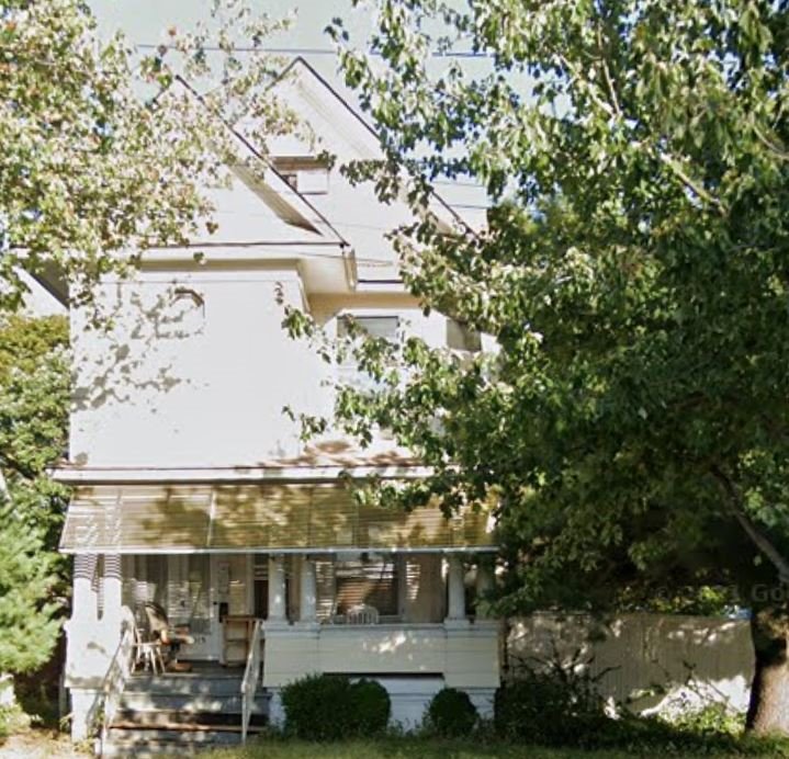
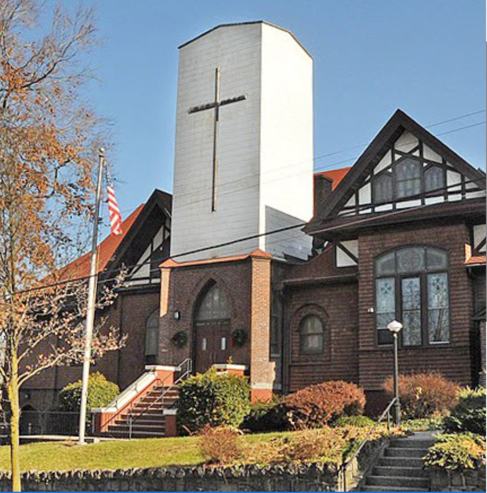
If one walked across the courts toward Jewett Avenue you would have encountered the same wire fence now running up Jewett Avenue. Cross over the fence and step onto a side walk that bordered Jewett Avenue. It was then was a cobble stone street complete with curbs, gutters and a former trolley rail track running up the center. Across the street, two plots south of Kinsley Avenue, was the only home on that block. That home still stands. Walk up to the corner of Jewett and College Avenues and look east. That was College Avenue then, an improved cobble stone street with a few scattered homes on either side. Diagonally across, you can see the still existing Emanuel Union Church.
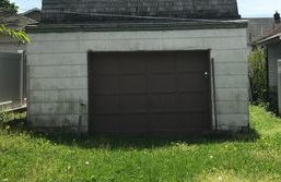
Walk down Indiana Avenue, now called College Avenue, a dirt road ending at a wooded area; across the street is the end of Wardwell, Fiske and Willard Avenues. Walk into what is now our club's parking lot, step inside our gate, stop and look to your immediate right where court one is now. You would have seen an outhouse standing at the top of court one. Just beyond that, you could have seen three sheds clustered together about 20 feet by 12 feet in dimension. Now walk over and stand on our deck again. Look toward the gate at the end of North Avenue and you would have been looking at the back of four structures labeled "Garages".
Starting just outside our gate and fence, looking from right to left, you would see three garages approximately 10 feet wide with varying depths of 15 feet to 20 feet. Further to the left, you would have seen a larger garage 40 feet wide, two stories high with an outside stairway at the far end. At the bottom of the stairway was a platform and an adjacent structure, 9 feet by 12 feet. Further out, in front of the garages, was the continuation of that wire fence, completely surrounding the then owner's property.
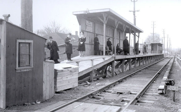
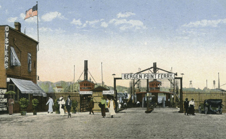
Beyond the wire fence was a dirt road, unnamed, running from Indiana Avenue north to the current Burnside Avenue where there was a former coal fired electric plant that electrified the trolley cars. The trolley system was built by the Prohibition Park Association to move park visitors from the Port Richmond Staten Island Railroad station and the Bergen Ferry at the foot of the now Port Richmond Ave. The Trolley system was discontinued in the fall of 1895 due to financial difficulties.
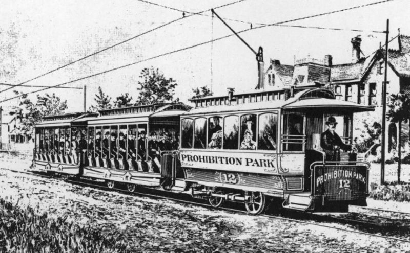
The garages prior to, and after the trolley system, were used to house the horses and coaches that taxied park visitors to and from the Port Richmond Staten Island Railroad station and the Bergen Ferry. Prohibition Park had some 200,000 to 300,000 visitors per year at its peak, with 60 thousand visitors the first year alone.
|
Information & History Provided by Greg Argila |
||